| |
The Place
History
Maps
Photos
Weather
The People
Census
Baptisms
Marriages
Burials
Directorys
External Sites
Links
Page
|
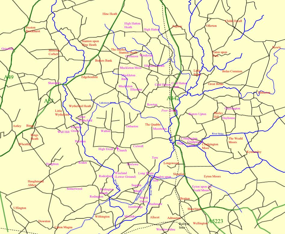
This is an amalgamation of maps roughly from the early 1800s to 2006. Although
most main roads are still present there are some that are not, there are
some that seem now to go nowhere on modern maps but on this map still do.
The railway line that used to run from Wellington to Market Drayton through
Crudgington no longer exists, neither does the Shropshire Union Canal, Shrewsbury
and Newport Branches (although there is a project
to reinstate parts, if not all, of this). At Longdon upon Tern
can be seen the first iron aqueduct spanning the River Tern built in 1796
at a cost of £1,750 and was likely designed by William Reynolds and
Thomas Telford and built by William Reynolds at Ketley.
I have tried to name as many places as possible from the parish registers
on this map in Magenta, with Red for others which may be found or for reference,
Slafford I understand is now called Sleapford. This map is not to scale.
|
|